Jesse in Toronto Neighbourhoods
Getting lost in one’s own neighbourhood takes dedication and skill. Having moved to the neighbourhood of Fairbank (check out Realosophy’s neighbourhood profile for school and housing stats) a year ago, I thought I had gotten a feel for my surroundings and that losing my way was a thing of the past. My confidence was shaken this afternoon as I did what I thought was un-doable and got lost ten minutes away from my house. Thank goodness I had my Vince Guaraldi cd to keep me company as I wove throughout the residential streets that make up Fairbank.
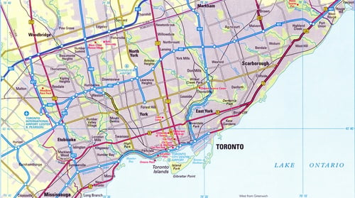
Fairbank’s borders are not as clearly defined as other Toronto Neighbourhoods. The northern and western boundaries follow old Belt-Line railroad tracks that are not always easy to see; the southernmost point ends just south of Morrison Avenue (a street that only runs about halfway across the southern boundary).
Fairbank is easily accessible via transit and driving, although one might cause more of a headache than the other. Both the 29 Dufferin and 32 Eglinton West routes run frequent daytime service that goes well into the late night. There is also an all-night 307 Eglinton West route that travels from the Yonge and Eglinton subway station to Toronto Pearson International Airport. Drivers have their work cut out for them as one-way streets appear throughout the residential streets that lie south of Castlefield Avenue. One-way streets do nothing but wreak havoc on the directionally challenged (did I mention that I got lost here?), my advice to you is to bring your Perly’s along with your patience if attempting to navigate this during peak traffic times.
Housing styles here are similar to that of neighbouring Glen Park and Downsview. Square bungalows and semi-detached two-storeys dominate the residential area. Situated amongst the streets are those homes that have received facelifts and second floors. I was surprised to find new stone and brick three-storey town homes tucked in at the end of more established streets, completely hidden unless you stumble upon them. The majority of homes were built very close together with not much but an alleyway between; this does anything but take away from the appeal of the neighbourhood. If anything, the homes have held on to the early twentieth-century era in which it was built.
The Castlefield Design and Decor District is located along Castlefield Avenue, in between Dufferin and Caledonia Road and is looking to expand. Here a do-it-yourselfer can find supplies for just about anything from bathroom fixtures to patio furniture. If the wind is blowing from the right direction you can smell all sorts of good things wafting from the Baker Street Bakery while selecting that perfect shade of granite.
In a neighbourhood that began as a village and was named after a nineteenth-century farm, Fairbank has done pretty well for itself. I can freely admit that I got lost in an area from which, if it weren’t for the trees, I could have seen my building. Being captivated in your surroundings to the point where you don’t really care where you are going says a lot for the neighbourhood. Maybe my Perly’s can stay at home a little while longer.
Jesse Fleming is a freelance writer based in Toronto. Email Jesse
Published: November 27, 2007