Skip to main content
Insights
Articles
Webinars
Reports
Open main navigation
Close main navigation
Show submenu for Insights
Insights
Insights
Articles
Webinars
Reports
Sign In
Search Articles
Search Articles
Blog
Tags
Market
Mortgage
This Week In Real Estate
Buying
Legal
Geotag: Toronto and GTA
Condos
Search Articles
Market
Mortgage
This Week In Real Estate
Buying
Legal
Geotag: Toronto and GTA
Condos
Get the Stories Behind The Sold Signs—
Delivered Right to Your Inbox.
Articles about Neighbourhood
Neighbourhood
,
MType: Data
,
Market
,
Geotag: Toronto and GTA
,
Realosophy
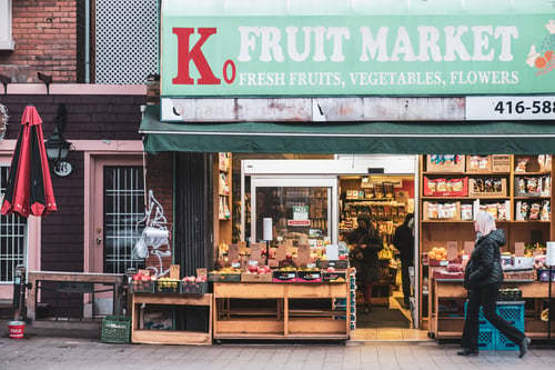
In-Depth Profiles for All Toronto and GTA Neighbourhoods
Neighbourhood
,
MType: Data
,
Market
,
Geotag: Toronto and GTA
,
Realosophy
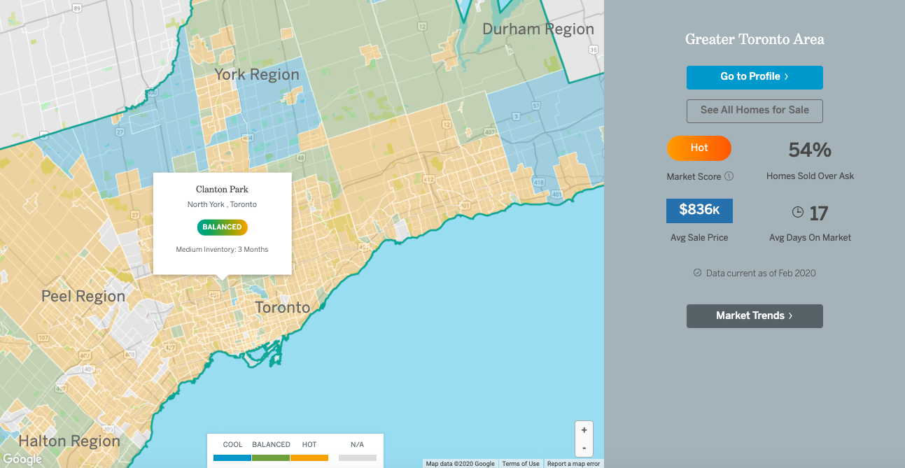
Map of Toronto and GTA by Neighbourhood with Real-Time Real Estate Trends
Buying
,
Neighbourhood
,
Geotag: Toronto and GTA
The GTA Neighbourhoods Home Buyers Should Avoid
For Sale
,
Neighbourhood
,
Geotag: Rockcliffe Smythe
,
Geotag: The Junction
Pick or Pass: The Neighbourhood to Watch for 2017
For Sale
,
Neighbourhood
,
Geotag: Toronto
,
Geotag: Scarborough
,
Geotag: Malvern
Pick or Pass: So, Let’s Talk About Malvern
For Sale
,
Neighbourhood
,
School
,
Geotag: The Beach
,
Geotag: Toronto
R Listing: Do School Districts Affect Home Values?
Buying
,
Neighbourhood
,
Geotag: Toronto
Pick or Pass: Affordable Spots for First-Time-Home-Buyers
Buying
,
Neighbourhood
,
Condos
Pick or Pass: If It Looks Too Good to Be True, It Just Might Be
Buying
,
For Sale
,
Neighbourhood
,
Geotag: Toronto
,
Geotag: Old East York
R-Listing: Why East York is Super Hot for Families
For Sale
,
Mortgage
,
Neighbourhood
,
Geotag: Regent Park
,
Geotag: Toronto
,
Market
Pick or Pass: Time for You to Consider Regent Park?
Buying
,
For Sale
,
Mortgage
,
Neighbourhood
Pick of the 6ix: Toronto's Listing of the Week
Neighbourhood
,
Top Ten
,
Geotag: Toronto
Toronto's Hottest Neighbourhoods - 2016
This Week In Real Estate
,
Neighbourhood
,
Market
Toronto Real Estate Roundup - March 28 2014
Neighbourhood
,
Top Ten
,
Geotag: Toronto
,
Market
Hottest Toronto Neighbourhoods for 2013
Neighbourhood
,
Top Ten
,
Geotag: Toronto
,
Market
Best Toronto Neighbourhoods 2013 - For Price Appreciation
Neighbourhood
,
School
,
Top Ten
,
Geotag: Toronto
,
Market
Best Toronto Neighbourhoods for Great Schools - 2012
Neighbourhood
,
School
,
Top Ten
,
Geotag: Toronto
,
Market
Most Improved Toronto Schools 2012
Neighbourhood
,
School
,
Top Ten
,
Geotag: Toronto
,
Market
What’s Driving Toronto Real Estate Prices Up? The School Factor
Neighbourhood
,
Top Ten
,
Geotag: Toronto
,
Market
3-Bedroom Subway Access for $500K - 2011
Neighbourhood
,
Market
Turf War Over Who Names Neighbourhoods
1
2
3
4
5
NEXT